

Why was there a Spanish territory in the middle of France in 1650?
A Tale of Dynasties, Enclaves, and Exclaves

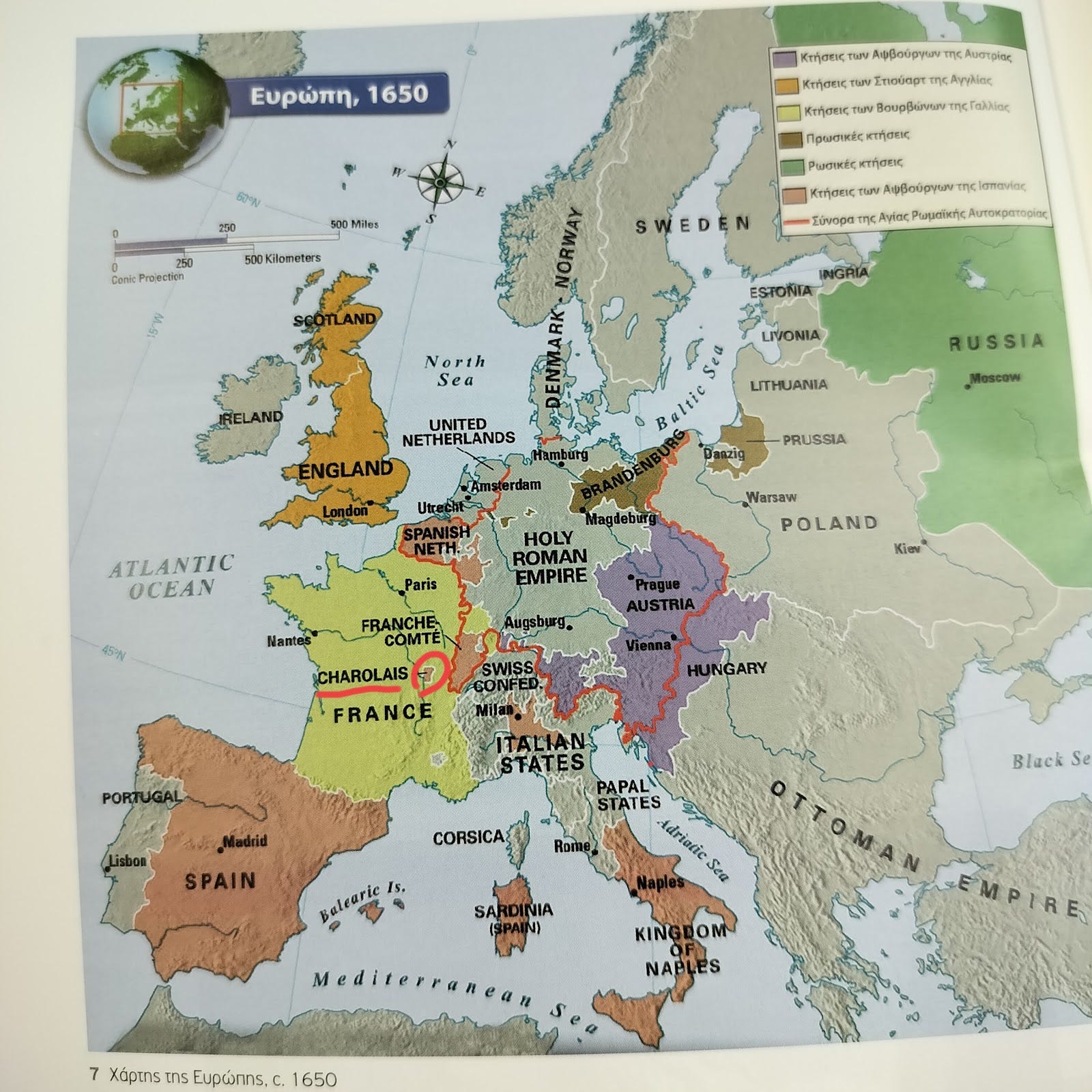
I stumbled upon a map a few hours ago, in Alkis Charalampidis’ book on Baroque, picturing Europe, c. 1650.
Aκολουθεί κείμενο στα ελληνικά*
One could find quite a few interesting things to comment on this map, but my eye was caught by a particular area with the most bizarre borders: Charolais, a county in the middle of France, with a French name apparently, appearing to be…Spanish territory? Ok, now I had to leave Rubens and Bernini aside and start digging.
When examining maps of Europe, not only from around 1650 but modern ones also, one might be surprised (ok, it was me, I was surprised) to find peculiar enclaves and exclaves.
An enclave is a territory that is entirely surrounded by the territory of only one other state or entity, while an an exclave is a portion of a state or district geographically separated from the main part, by some surrounding alien territory.
Such territorial puzzles are not unique to early modern France. Modern Europe still features notable examples:
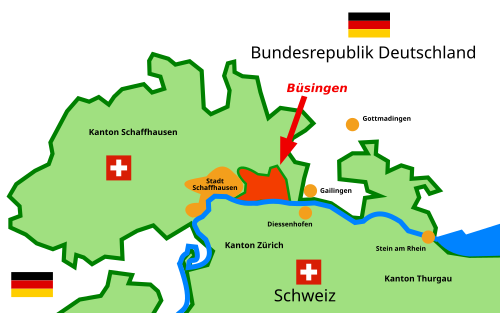
Switzerland’s Büsingen am Hochrhein is one of them. It is a German exclave entirely surrounded by Swiss territory, creating a complex jurisdictional situation:
In Belgium, there’s another interesting case. A village called Baarle-Hertog consists of multiple Belgian enclaves within the Netherlands, intertwined with Dutch enclaves inside Belgium:
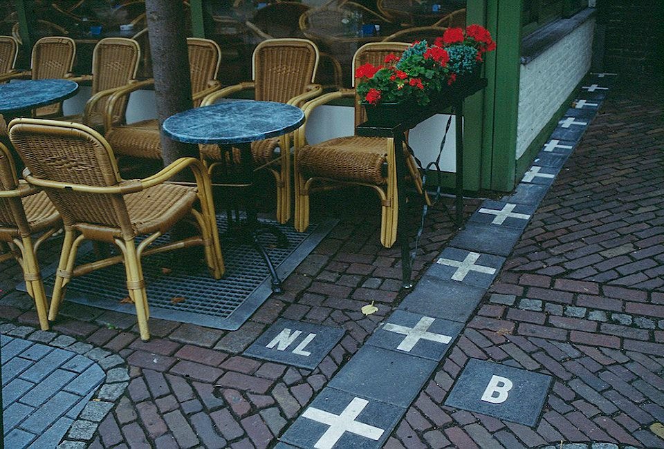
The Netherlands has the municipality of Baarle-Nassau, which contains Dutch exclaves surrounded by Belgian territory:
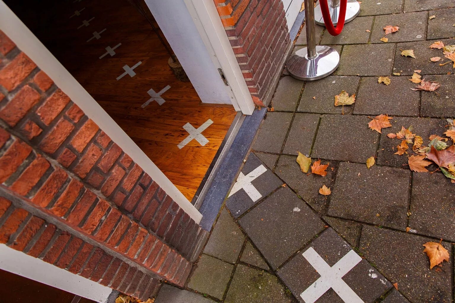
Basically, Baarle-Nassau and Baarle-Hertog are the names of the same place, just for different parts of it. The first one for the Belgium parts and the second one for the Dutch ones. Still with me?
Like the Charolais that I noticed, these curious cartographic details reveal…
